


Few places on earth feel further from a flood zone than Honolulu. For most of its history, Hawaii has been shielded from hurricanes by something simple: cold water. A hurricane is essentially a giant heat engine, and it needs sea surface temperatures of at least 80°F (26.5°C) to keep the evaporation and convection cycle running.
The waters surrounding the islands, especially to the north and east, usually sit in the mid-to-high 70s, cool enough to starve an approaching storm and pull it apart before it can organize a direct hit on O’ahu.
But that shield only works against one kind of threat – and it did nothing to stop the March 2026 Honolulu flooding.
Why Honolulu Flooded
Over a two-week stretch, back-to-back storms delivered Hawai’i’s worst flooding in more than 20 years. The damage topped $1 billion. Hundreds of people were pulled from rising water by boat, jet ski, and helicopter. And a 120-year-old dam came within a few feet of failing above thousands of homes.
Between March 10 and March 24, 2026, two subtropical low-pressure systems known as Kona Lows stalled over the Hawaiian Islands in quick succession. Unlike the trade-wind showers Hawaii is built for, Kona Lows pull deep tropical moisture up from the south and wring it out over the islands for days.
The result wasn’t a rainy week. It was a disaster:
- Rainfall totals exceeded 30 inches in some areas, with 8 to 12 inches falling overnight on already-saturated ground.
- Record daily rainfall was set in Honolulu, Hilo, Līhu’e, and Kahului.
- Wind gusts of 60 to 100 mph downed power infrastructure, leaving as many as 115,000 O’ahu residents without electricity.
- On O’ahu’s North Shore, floodwaters pushed homes off their foundations, submerged vehicles, and cut off entire communities in Hale’iwa, Waialua, and Moku-le’ia.
Officials ordered 5,500 residents evacuated downstream of the Wahiawā Dam after water rose to within three feet of the crest – an “imminent dam failure” warning that, thankfully, never became reality.
By the end of the month, the President had approved a Major Disaster Declaration, unlocking federal assistance for the City and County of Honolulu and the counties of Hawaii and Maui. Barely two weeks later, in early April, more heavy rain and flash flooding returned.
If it can happen there, the comfortable assumption that “we’re not really a flood area” deserves a second look – no matter where your property sits.
Why the Flooding Map Didn’t Warn Everyone
Here’s the uncomfortable truth behind the headlines: the properties hit hardest by the Honolulu flooding weren’t all beachfront. Much of the destruction came from flash flooding and stormwater – water that overwhelms streets, streams, and drainage systems miles from the shoreline.
Three factors turned rain into catastrophe:
- Terrain that funnels water fast – Honolulu’s steep valleys send runoff racing toward developed areas at the bottom. Water arrives with little warning and nowhere to go.
- Saturated ground – The first storm soaked the soil, the second storm had nothing to absorb it, so nearly all of it became runoff.
- Urban drainage limits – Storm systems built for typical rainfall simply cannot move 8 inches of water in a few hours. When they back up, the overflow finds doorways, garages, and ground-floor commercial space.
None of that requires an ocean view. It requires rain, a slope, and a building in the path – a description that fits an enormous share of commercial and residential property across the country, not just in Hawaii.
The lesson isn’t “Hawai’i.” It’s “everywhere.”
FEMA flood maps are essential, but they were never designed to capture every risk, especially the flash-flood and stormwater risk that climate patterns are intensifying. Properties well outside a designated high-risk zone flood every year. Inland office parks flood, suburban warehouses flood, parking structures downtown flood.
The Honolulu flooding is simply the most vivid recent reminder that flood risk is defined by water behavior, not by reputation. The question for a property owner isn’t “Am I in a flood zone?” It’s “Where would water go if my drainage was overwhelmed – and what’s in its way?”
How Flood Barriers Protect a Building
Once you accept that the water can come, protection becomes an engineering question, not a hopeful one. Sandbags and reactive scrambling don’t hold up against 8 inches of rain overnight. Engineered flood barriers do.
At Flood Risk America, that means matching the right defense to each vulnerable opening on a property:
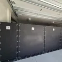
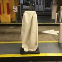
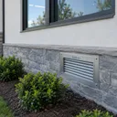
- Flood barriers and covers that seal the specific gaps water exploits – doorways, loading docks, vents, stairwells, and below-grade entries.
- Permanent and passive systems that are always in place, so protection doesn’t depend on someone deploying them at 2 a.m. as the water rises.
- Rapid-deploy barriers for perimeters and access points that need to stay usable day-to-day but sealed when a storm approaches.
- FEMA-compliant solutions and consulting, so the protection you install also satisfies the building, safety, and floodplain requirements your property has to answer to.
That last point matters more than most owners realize. Flood protection that isn’t code-compliant can create as many problems as it solves. Protection that is – engineered, tested, and documented – defends the building and holds up to inspection.
Don’t Wait For Your Own “Worst in 20 Years”
Every community that floods believed it wouldn’t. The Honolulu flooding of March 2026 is a reminder that the gap between “unlikely” and “unprotected” is where the billion-dollar losses live.
The best time to assess a property’s flood exposure is before the forecast turns serious, while there’s time to engineer a real defense rather than react to rising water. Flood Risk America will assess your property’s actual exposure and recommend the right combination of protection for your openings, your use case, and your compliance requirements.
Speak to a flood expert today for more information.