
Having an accurate flood map is important for effective flood mitigation and low flood insurance premiums. So how does commercial flood mapping work? At Flood Risk America(FRA), we create our flood maps using the unique LiDAR technology. The accurate Light Detection and Ranging Technology are attributed to its pulsed laser used to calculate an object’s variable distance from the eaths suranface. An airborne system then generates high-resolution 3D high-resolution digital elevation model information about the earth’s surface. Using this technology, the flood risk experts at FRA have the ability to target an object or property in question to create an accurate model of the flood map. Conventional methods are unable to create a high-resolution elevation model and have low accuracy in their results.
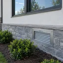
Without a proper understanding of your property’s elevation, you cannot create an effective flood mitigation plan. Knowing the potential areas where water can pool to create pressure against your structure will make the difference between extensive damages due to flooding. With LiDAR technology, FRA can estimate water will flow during a flood and create a plan to safely control water away from your property. Do you know the potential elevation of floodwaters on your property? Are your windows and doors properly protected? With information about your elevation and reviewing historical events, flood risk experts can customize flood barriers to seal any at-risk opening.
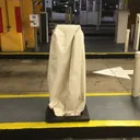
Commercial buildings often sport large low elevation garages with a convenient elevator. Although luxurious, garages and elevators are vulnerable to flooding and can be overlooked in flood mitigation planning. Without property flood protection, water can seep into these vulnerable areas can damage the structural integrity of your building. Take the first step and receive your flood map assessment today. Experts suggest you should update your flood map every 5 years.
LiDAR technology FEMA recognized and insurance industry approved. With an FRA flood map and vulnerablablity assessment, followed by a flood mitigation plan, insurance carriers may reduce their client’s flood insurance premiums by up to 75%.
Is your commercial property protected from flood damages? Book your flood map assessment today.
Speak with the experts, call (561) 644-3311 to get your free quote today.